
Here are some photos I took of the Aurora on the 12 November 2025


Tracked with all available NORAD satellite data on Stellarium. Notice the linear movement as depicted by the red line — very characteristic of a satellite in orbit.
The ERS-1 was the first environmental monitoring satellite developed by ESA. The mission detected land and ocean surface change and provided observation data on oceans, polar ice, vegetation, geology, meteorology, and ecology.
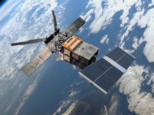
Cloud type, ocean imagery, surface temperature, vegetation type, snow and ice coverage, wind speed over sea, wave height, topography, ozone levels, atmospheric humidity, and more.
MWR, ATSR/M, AMI/SAR/Image, AMI/Scatterometer, ERS Comms, ATSR, AMI/SAR/Wave, RA.
Source: eoPortal — ERS-1 Quick Facts